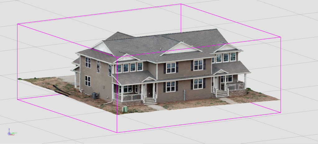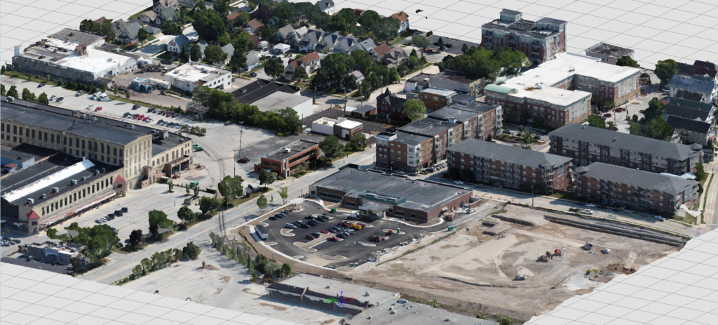

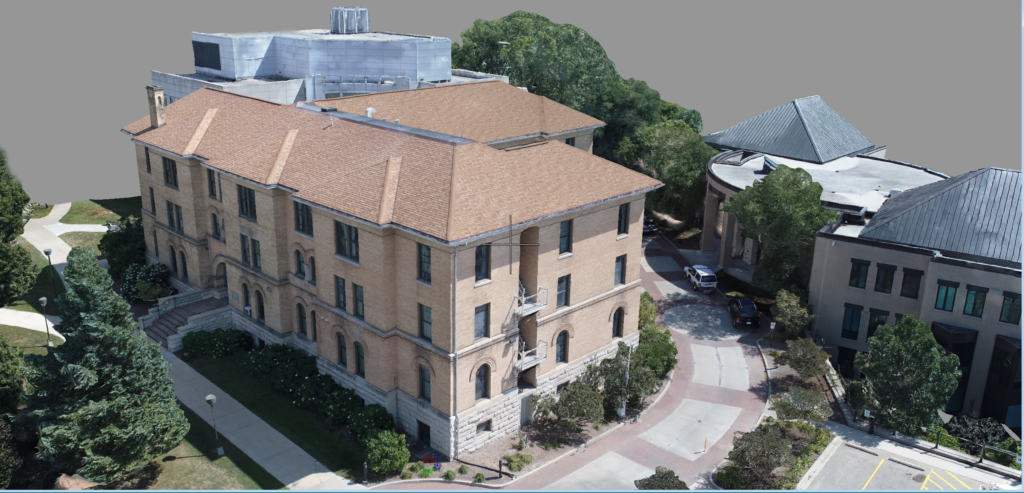
Photogrammetry, the science of making measurements from photographs, employs high-speed imaging and remote sensing in order to detect, measure and record complex 2D and 3D fields. This data can be collected utilizing cameras mounted on UAV (Unmanned Aerial Vehicle) equipment or terrestrial equipment and vehicles. Photogrammetry will provide our partners with a high-resolution 3D reality capture that represents current “asset” conditions, as well as the ability to obtain detailed information through photo analysis.